![](/images/other/stat-length.png)
![Randonnée A pied Gemeinde Scheffau am Wilden Kaiser - Auwaldrunde - Photo](https://media.geolcdn.com/t/1900/400/ext.pjpeg?maxdim=2&url=https%3A%2F%2Fmedia.geolcdn.com%2Ff%2F3a82ec08-361f-407c-b990-092670ab9561.jpeg)
Auwaldrunde
SityTrail - itinéraires balisés pédestres
Tous les sentiers balisés d’Europe PRO
![Longueur](/images/other/stat-length.png)
![Altitude max](https://static1.geolcdn.com/siteimages/upload/files/1508320355ic_sort_altitude_max_24dp.png)
![Dénivelé positif](https://static1.geolcdn.com/siteimages/upload/files/1508320355ic_sort_den_pos_24dp.png)
![Km-Effort](/images/other/stat-length.png)
![Altitude min](https://static1.geolcdn.com/siteimages/upload/files/1508320355ic_sort_altitude_min_24dp.png)
![Dénivelé négatif](https://static1.geolcdn.com/siteimages/upload/files/1508320355ic_sort_den_neg_24dp.png)
![Boucle](https://static1.geolcdn.com/siteimages/upload/files/16400158638029165_repeat_loop_refresh_sync_direction_icon.png)
![A pied](https://static1.geolcdn.com/sitytour/trail-icons/100.png)
2h15
Difficulté : Facile
![Scannez ce code QR pour ouvrir la randonnée dans l'application SityTrail](https://capi.geolives.com/qq0zvz2zws4bq2lad0pu/sitytour/trails/3128944/qr.png?size=200)
Application GPS de randonnée GRATUITE
À propos
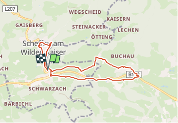
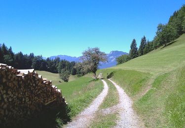
Randonnée A pied de 7,7 km à découvrir à Tyrol, Bezirk Kufstein, Gemeinde Scheffau am Wilden Kaiser. Cette randonnée est proposée par SityTrail - itinéraires balisés pédestres.
Description
Randonnée créée par Lauf- und Nordic Walking Region Wilder Kaiser.
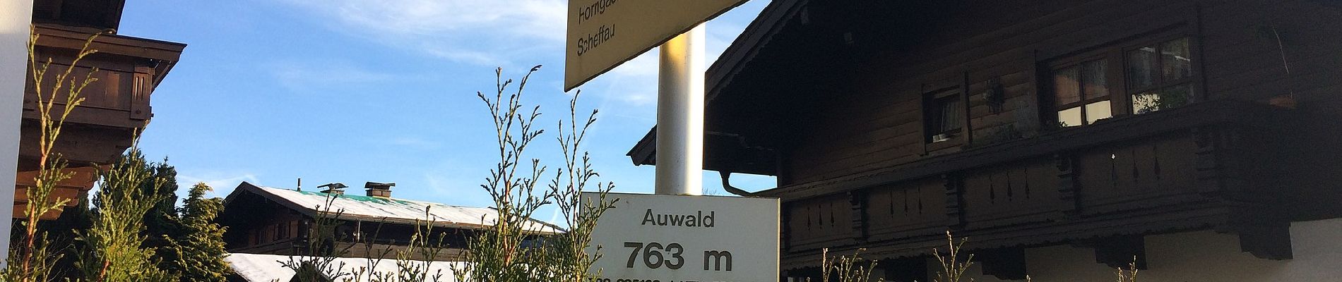
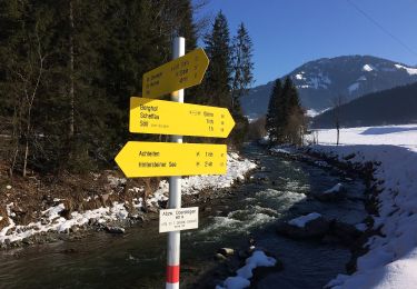
Route 2020 vor Ort Übersichtskarte und nur noch vereinzelt Wegweisschilder
Symbole: Weiße Schilder mit schwarzem Richtungspfeil und türkiesem Streifen mit dem Namen "Auwaldrunde"
Localisation
Commentaires
Randonnées à proximité
![Randonnée A pied Gemeinde Scheffau am Wilden Kaiser - Blaikenrunde - Photo](https://media.geolcdn.com/t/375/260/ext.jpg?maxdim=2&url=https%3A%2F%2Fmedia.geolcdn.com%2Ff%2Ff62c0da4-e38c-4f86-bb60-08e7cedb9a5c.jpeg)
![A pied A pied](https://static1.geolcdn.com/sitytour/trail-icons/100.png)
A pied
![](/images/other/stat-length.png)
![](https://static1.geolcdn.com/siteimages/upload/files/16400158638029165_repeat_loop_refresh_sync_direction_icon.png)
![Randonnée A pied Gemeinde Scheffau am Wilden Kaiser - Hintersteinersee Runde - Photo](https://media.geolcdn.com/t/375/260/ext.jpg?maxdim=2&url=https%3A%2F%2Fmedia.geolcdn.com%2Ff%2F7ce82edb-c501-4d03-be1c-122723060ba0.jpeg)
![A pied A pied](https://static1.geolcdn.com/sitytour/trail-icons/100.png)
A pied
![](/images/other/stat-length.png)
![](https://static1.geolcdn.com/siteimages/upload/files/16400158638029165_repeat_loop_refresh_sync_direction_icon.png)
![Randonnée A pied Gemeinde Söll - [40] Wanderweg - Brandstadl - Photo](https://media.geolcdn.com/t/375/260/ext.jpg?maxdim=2&url=https%3A%2F%2Fmedia.geolcdn.com%2Ff%2Ff5e792c0-e7a9-440a-9b2b-4120aabc3500.jpeg)
![A pied A pied](https://static1.geolcdn.com/sitytour/trail-icons/100.png)
A pied
![](/images/other/stat-length.png)
![](https://static1.geolcdn.com/siteimages/upload/files/16400158638029165_repeat_loop_refresh_sync_direction_icon.png)
![Randonnée A pied Gemeinde Ellmau - Wanderweg 14 - Wilder Kaiser - Photo](https://media.geolcdn.com/t/375/260/ext.jpg?maxdim=2&url=https%3A%2F%2Fmedia.geolcdn.com%2Ff%2Fbab70f22-d8e2-49f4-93b1-d49ec6cea7db.jpeg)
![A pied A pied](https://static1.geolcdn.com/sitytour/trail-icons/100.png)
A pied
![](/images/other/stat-length.png)
![](https://static1.geolcdn.com/siteimages/upload/files/16400158638029165_repeat_loop_refresh_sync_direction_icon.png)
![Randonnée A pied Gemeinde Söll - Wanderweg 55 - Kaisergebirge - Photo](https://media.geolcdn.com/t/375/260/ext.jpg?maxdim=2&url=https%3A%2F%2Fmedia.geolcdn.com%2Ff%2F5aab65c3-b630-4e0d-bdb6-de4c4b5a6c52.jpeg)
![A pied A pied](https://static1.geolcdn.com/sitytour/trail-icons/100.png)
A pied
![](/images/other/stat-length.png)
![](https://static1.geolcdn.com/siteimages/upload/files/16400158638029165_repeat_loop_refresh_sync_direction_icon.png)
![Randonnée A pied Gemeinde Söll - Wanderweg 56a - Söll - Photo](https://media.geolcdn.com/t/375/260/ext.jpg?maxdim=2&url=https%3A%2F%2Fmedia.geolcdn.com%2Ff%2Fe8529c30-ba3d-4ad3-9297-7bdb3eed3004.jpeg)
![A pied A pied](https://static1.geolcdn.com/sitytour/trail-icons/100.png)
A pied
![](/images/other/stat-length.png)
![](https://static1.geolcdn.com/siteimages/upload/files/16400158638029165_repeat_loop_refresh_sync_direction_icon.png)
![Randonnée A pied Gemeinde Ellmau - Wanderweg 28 - Ellmau - Photo](https://media.geolcdn.com/t/375/260/ext.jpg?maxdim=2&url=https%3A%2F%2Fmedia.geolcdn.com%2Ff%2F44898ea8-a8d9-4c5e-bd6c-b39a1f30504a.jpeg)
![A pied A pied](https://static1.geolcdn.com/sitytour/trail-icons/100.png)
A pied
![](/images/other/stat-length.png)
![](https://static1.geolcdn.com/siteimages/upload/files/16400158638029165_repeat_loop_refresh_sync_direction_icon.png)
![Randonnée A pied Gemeinde Scheffau am Wilden Kaiser - Wanderweg 57 - Wilder Kaiser - Photo](https://media.geolcdn.com/t/375/260/ext.jpg?maxdim=2&url=https%3A%2F%2Fmedia.geolcdn.com%2Ff%2F5a7c03dd-c48c-4c83-ac24-883b19017390.jpeg)
![A pied A pied](https://static1.geolcdn.com/sitytour/trail-icons/100.png)
A pied
![](/images/other/stat-length.png)
![](https://static1.geolcdn.com/siteimages/upload/files/16400158638029165_repeat_loop_refresh_sync_direction_icon.png)
![Randonnée A pied Gemeinde Söll - Wanderweg 56 - Wilder Kaiser - Photo](https://media.geolcdn.com/t/375/260/ext.jpg?maxdim=2&url=https%3A%2F%2Fmedia.geolcdn.com%2Ff%2F7903931b-9066-46dc-80a3-8f88b9a9d02e.jpeg)
![A pied A pied](https://static1.geolcdn.com/sitytour/trail-icons/100.png)
A pied
![](/images/other/stat-length.png)
![](https://static1.geolcdn.com/siteimages/upload/files/16400158638029165_repeat_loop_refresh_sync_direction_icon.png)